ANTARCTICA MAP
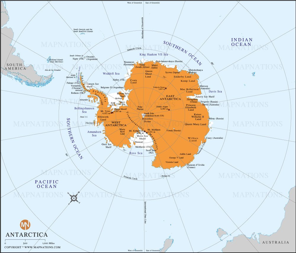
This is a political map of Antarctica, showing major regions, research stations, and surrounding oceans. The continent is divided into two main parts: East Antarctica and West Antarctica. East Antarctica, marked in orange, includes notable areas such as Queen Maud Land, Enderby Land, and Wilkes Land. West Antarctica includes areas such as Marie Byrd Land and Ellsworth Land.
The map depicts several international research stations operated by countries such as the United States, Russia, Australia, and Argentina. For example, McMurdo Station, located on Ross Island, is one of the largest research facilities in Antarctica and is operated by the United States. Other stations such as Mawson (Australia) and Mirny (Russia) are also displayed.
Antarctica is surrounded by the Southern Ocean, sections of which are called the Weddell Sea, the Ross Sea, and the Bellingshausen Sea. The map also shows Antarctica's proximity to South America, particularly the southern tip of Argentina and Chile and nearby islands including South Georgia and the South Sandwich Islands.
This map provides a detailed view of Antarctica's geographic features, including ice shelves such as the Ross Ice Shelf and the Amery Ice Shelf, which extend from the land into the ocean.

How many countries are there in Antarctica continent?
Antarctica has no countries or permanent residents. It’s governed by an international treaty, designating it for peaceful, scientific research and preservation.


