EUROPE MAP
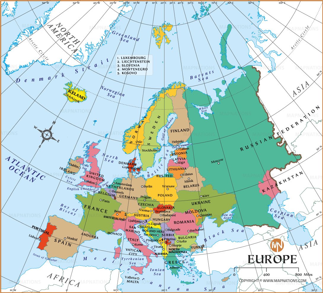
AThis political map of Europe shows the continent's countries, capitals, and major cities. It includes 44 countries, each with borders shaded in different colors. Notable countries such as France, Germany, Italy, and Russia appear distinctly alongside smaller countries such as Luxembourg, Andorra, and Vatican City. The map also depicts the major water bodies surrounding Europe, such as the Atlantic Ocean to the west, the Arctic Ocean to the north, and the Mediterranean, Black, and Caspian Seas to the south and southeast. This layout allows for a quick understanding of Europe's geopolitical boundaries, neighboring regions such as Asia to the east, and various European seas such as the North, Norwegian, and Barents.
A compass rose indicates orientation, while clear labeling and lines make it easy to distinguish country names and capitals. The map also gives insight into Europe's diverse geographic layout, from the Iberian Peninsula in the southwest to Scandinavia in the north and Eastern Europe extending to the Ural Mountains.

How many countries are there in Europe?
There are 44 countries in Europe, including well-known nations like France, Germany, Italy, and the United Kingdom, as well as smaller countries like Monaco, San Marino, and Vatican City.
Countries in Europe
44
- Subregion
- Russia
- Germany
- United Kingdom
- France
- Italy
- Spain
- Poland
- Ukraine
- Romania
- Netherlands
- Belgium
- Czech Republic (Czechia)
- Sweden
- Portugal
- Greece
- Hungary
- Austria
- Belarus
- Switzerland
- Bulgaria
- Serbia
- Denmark
- Finland
- Norway
- Slovakia
- Ireland
- Croatia
- Bosnia and Herzegovina
- Moldova
- Lithuania
- Albania
- Slovenia
- Latvia
- North Macedonia
- Estonia
- Luxembourg
- Montenegro
- Malta
- Iceland
- Andorra
- Liechtenstein
- Monaco
- San Marino
- Holy See


