MAP OF AUSTRALIA

About Austrlaia Map
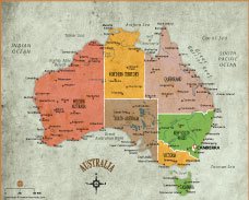
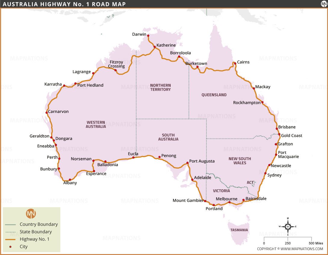
This detailed map of Australia provides a comprehensive view of the country, highlighting its states and territories, major cities, roads, rivers, and key geographic features. Australia, known for its vast landscapes and unique biodiversity, is divided into six states—New South Wales, Victoria, Queensland, Western Australia, South Australia, and Tasmania—and two mainland territories: the Northern Territory and the Australian Capital Territory (ACT).
The map prominently features the nation's capital, Canberra, which is located within the ACT. Major cities such as Sydney, Melbourne, Brisbane, Perth, and Adelaide are also clearly depicted, serving as important cultural, economic, and political centers. The map shows the iconic Great Barrier Reef along the northeast coast, showcasing Australia's unique marine ecosystem.
Major road networks and transportation routes are outlined, providing a valuable resource for travelers and logistics planning. Rivers such as the Murray and Darling are visible, emphasizing the role of waterways in Australia's ecology and agriculture. The map also depicts airports, making it a useful tool for understanding connectivity within the country.
For nature lovers, the map depicts national parks such as Kakadu, the Great Sandy Desert and the famous Uluru-Kata Tjuta National Park, reflecting Australia's commitment to preserving its natural heritage. It also details important geographic landmarks such as the Great Dividing Range and the vast Outback, which defines much of the country's interior.
Frequently Asked Questions about the Australia
1. Where is Australia located?
Australia is located in the Southern Hemisphere, between the Indian and Pacific Oceans. It is both a country and a continent.
2. What is the capital of Australia?
The capital city of Australia is Canberra, not Sydney or Melbourne as many people assume.
3.What is Australia famous for?
Australia is known for its unique wildlife, the Great Barrier Reef, Sydney Opera House, vast deserts, beaches, and multicultural society.
4. What is the climate like in Australia?
Australia has diverse climates—tropical in the north, temperate in the south, and arid in the central desert regions.
5. Do people in Australia speak English?
Yes. English is the official language, though many people also speak additional languages due to cultural diversity.
6. Is Australia safe for tourists?
Australia is considered very safe, with low crime rates. However, travelers should be cautious of wildlife, bushfires, strong ocean currents, and extreme weather.
7. What currency is used in Australia?
Australia uses the Australian Dollar (AUD), available in both coins and polymer banknotes.
- Afghanistan
- Albania
- Algeria
- Andorra
- Angola
- Antigua and Barbuda
- Argentina
- Armenia
- Australia
- Austria
- Azerbaijan
- Bahrain
- Bangladesh
- Barbados
- Belarus
- Belgium
- Belize
- Benin
- Bhutan
- Bolivia
- Bosnia and Herzegovina
- Botswana
- Brazil
- Brunei
- Bulgaria
- Burkina Faso
- Burma (Myanmar)
- Burundi
- Cabo Verde
- Cambodia
- Cameroon
- Canada
- Central African Republic
- Chad
- Chile
- China
- Colombia
- Comoros Islands
- Democratic Republic of the Congo
- Costa Rica
- Cote d'Ivoire
- Croatia
- Cuba
- Cyprus
- Czechia
- Denmark
- Djibouti
- Dominica
- Dominican Republic
- Ecuador
- Egypt
- El Salvador
- England
- Equatorial Guinea
- Eritrea
- Estonia
- eSwatini (formerly Swaziland)
- Ethiopia
- Federated States of Micronesia
- Fiji
- Finland
- France
- Gabon
- The Gambia
- Georgia
- Germany
- Ghana
- Greece
- Grenada
- Guatemala
- Guinea
- Guinea-Bissau
- Guyana
- Haiti
- Holy See
- Honduras
- Hungary
- Iceland
- India
- Indonesia
- Iran
- Iraq
- Ireland
- Israel
- Italy
- Jamaica
- Japan
- Jordan
- Kazakhstan
- Kenya
- Kiribati
- Kosovo
- Kuwait
- Kyrgyzstan
- Laos
- Latvia
- Lebanon
- Lesotho
- Liberia
- Libya
- Liechtenstein
- Lithuania
- Luxembourg
- Madagascar
- Malawi
- Malaysia
- Maldives
- Mali
- Malta
- Marshall Islands
- Mauritania
- Mauritius
- Mexico
- Moldova
- Monaco
- Mongolia
- Montenegro
- Morocco
- Mozambique
- Namibia
- Nauru
- Nepal
- Netherlands
- New Zealand
- Nicaragua
- Niger
- Nigeria
- North Korea
- Norway
- Oman
- Pakistan
- Palau
- Panama
- Papua New Guinea
- Paraguay
- Peru
- Philippines
- Poland
- Portugal
- Puerto Rico (USA)
- Qatar
- North Macedonia
- Romania
- Russia
- Rwanda
- Saint Kitts and Nevis
- Saint Lucia
- Saint Vincent & the Grenadines
- Samoa
- San Marino
- Sao Tome and Principe
- Saudi Arabia
- Scotland
- Senegal
- Serbia
- Seychelles
- Sierra Leone
- Singapore
- Slovakia
- Slovenia
- Solomon Islands
- Somalia
- South Africa
- South Korea
- South Sudan
- Spain
- Sri Lanka
- Sudan
- Suriname
- Sweden
- Switzerland
- Syria
- Tajikistan
- Taiwan
- Tanzania
- Thailand
- The Bahamas
- Timor-Leste
- Togo
- Tonga
- Trinidad and Tobago
- Tunisia
- Turkey
- Turkmenistan
- Tuvalu
- Uganda
- Ukraine
- United Arab Emirates
- United Kingdom
- United States of America
- Uruguay
- Uzbekistan
- Vanuatu
- Western Sahara
- Venezuela
- Vietnam
- Yemen
- Zambia
- Zimbabwe


