MAP OF REPUBLIC OF CHINA
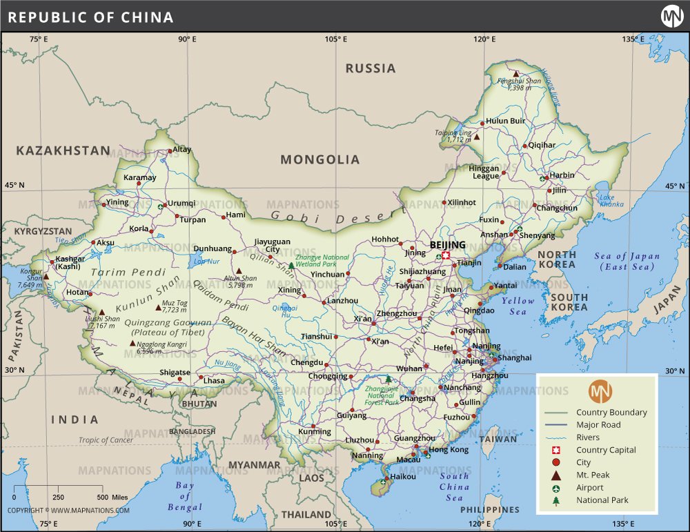
This map of China provides a detailed representation of the country's geography, infrastructure, and major landmarks. It depicts major cities such as Beijing, Shanghai, Guangzhou, and Chengdu, as well as smaller but important towns spread across the vast landscape. Major road networks connecting different parts of the country are clearly marked, reflecting the extensive transportation infrastructure that supports one of the world's largest economies. Geographically, China is diverse, stretching from the arid deserts of the Gobi in the north to the lush subtropical regions in the south. The map also shows the high Himalayas and the Tibetan Plateau in the west, emphasizing China's rich topographic diversity. Rivers such as the Yangtze, Yellow, and Pearl are labeled, reflecting their importance in China's history, culture, and economy. National parks and mountain peaks such as Mount Everest (shared with Nepal) and Mount Tai are included, giving an insight into China's natural beauty. Airports and transportation hubs are marked to guide travelers, making this map an essential tool for understanding China's connectivity.

Additionally, the map clearly defines the country's borders, showing neighboring countries such as Russia, India, Mongolia, and Vietnam. It helps put China's geopolitical position in Asia into context.
Whether you're a student, a traveler, or just someone interested in geopolitics, this map is a valuable resource for visualizing China's vast territory. It also provides information about how the country's physical geography has influenced its development, from trade and transportation to cultural integration. Overall, this comprehensive map serves as both an educational and practical tool for exploring the vast and diverse nation of China.


