WORLD RIVER MAP
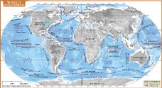
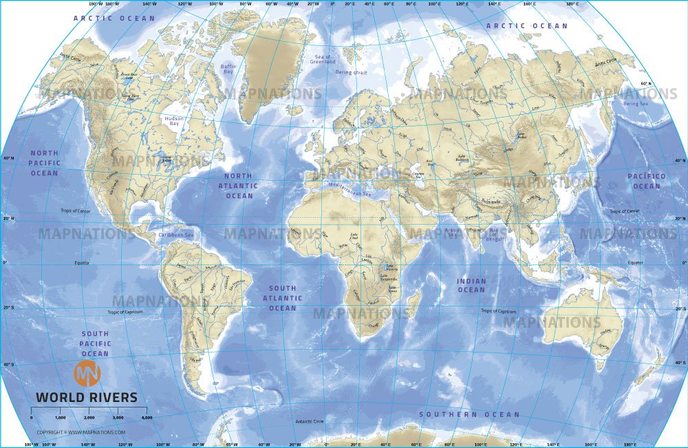
This World River Map presents a comprehensive overview of major rivers around the world, tracing their routes through various continents and highlighting their significant impact on geography, ecosystems, and human civilization. The map displays major rivers such as the Amazon in South America, the Nile in Africa, the Mississippi in North America, the Yangtze in Asia, and the Danube in Europe, each of which play a vital role in the environmental and economic landscape of their respective regions.
The map effectively demonstrates how rivers connect different regions, transport water from high elevations to the oceans and support extensive ecosystems along their routes. For example, the Amazon River Basin is one of the richest ecosystems in the world, with diverse species and dense rainforests. The Nile River, flowing through the arid regions of northeastern Africa, has been central to the development of agriculture and civilization, especially in Egypt. Similarly, rivers such as the Ganges in India hold cultural and spiritual significance, serving as lifelines for millions of people who depend on them for agriculture, drinking water, and rituals.
Additionally, the map shows the network of rivers that drain into seas and oceans, with many rivers forming deltas when they meet these large water bodies. Rivers are important for transporting sediment and nutrients, which helps create fertile land around their floodplains and deltas.
This map provides a valuable resource for understanding the global distribution of rivers and their importance to environmental and human systems. It highlights how rivers are integral to shaping landscapes, supporting biodiversity, enabling agriculture, and facilitating trade and transportation routes. By visually outlining the routes of these waterways, the map emphasizes the interconnectedness of water systems around the world and the role rivers play in sustaining life and civilizations across continents.
Major River of the world
Here are some of the major rivers in the world, each known for its length, volume, or historical and ecological significance:
- Amazon River (South America) – The largest river by discharge volume and one of the longest, flowing through the Amazon rainforest.
- Nile River (Africa) –Traditionally considered the longest river, flowing through northeastern Africa and vital to Egypt's agriculture and history.
- Yangtze River (China) –The longest river in Asia and the third longest in the world, playing a critical role in China's economy and culture.
- Mississippi-Missouri River System (United States) – North America's longest river system, flowing from the Rockies to the Gulf of Mexico.
- Yenisei River (Russia) – One of Siberia's major rivers, flowing into the Arctic Ocean, and among the largest river systems in the world.
- Yellow River (Huang He) (China) – Known as the "Cradle of Chinese Civilization," it's the second-longest river in China.
- Congo River (Africa) – The second longest in Africa and the deepest in the world, flowing through the Congo rainforest.
- Mekong River (Southeast Asia) – A crucial waterway for several countries, supporting biodiversity and local economies.
- Ganges River (India/Bangladesh) – Sacred to millions of Hindus, it plays an essential role in the cultural and agricultural life of India.
- Volga River (Russia) – The longest river in Europe, crucial to Russia's transport and economy.
- Danube River (Europe) – Flowing through Central and Eastern Europe, it passes through 10 countries and is vital for trade and transport.
- Murray-Darling River System (Australia) – The primary river system in Australia, essential for agriculture in the southeast.
These rivers support diverse ecosystems, supply water for agriculture, industry, and drinking, and have shaped human civilization for thousands of years.
- Afghanistan
- Albania
- Algeria
- Andorra
- Angola
- Antigua and Barbuda
- Argentina
- Armenia
- Australia
- Austria
- Azerbaijan
- Bahrain
- Bangladesh
- Barbados
- Belarus
- Belgium
- Belize
- Benin
- Bhutan
- Bolivia
- Bosnia and Herzegovina
- Botswana
- Brazil
- Brunei
- Bulgaria
- Burkina Faso
- Burma (Myanmar)
- Burundi
- Cabo Verde
- Cambodia
- Cameroon
- Canada
- Central African Republic
- Chad
- Chile
- China
- Colombia
- Comoros Islands
- Democratic Republic of the Congo
- Costa Rica
- Cote d'Ivoire
- Croatia
- Cuba
- Cyprus
- Czechia
- Denmark
- Djibouti
- Dominica
- Dominican Republic
- Ecuador
- Egypt
- El Salvador
- England
- Equatorial Guinea
- Eritrea
- Estonia
- eSwatini (formerly Swaziland)
- Ethiopia
- Federated States of Micronesia
- Fiji
- Finland
- France
- Gabon
- The Gambia
- Georgia
- Germany
- Ghana
- Greece
- Grenada
- Guatemala
- Guinea
- Guinea-Bissau
- Guyana
- Haiti
- Holy See
- Honduras
- Hungary
- Iceland
- India
- Indonesia
- Iran
- Iraq
- Ireland
- Israel
- Italy
- Jamaica
- Japan
- Jordan
- Kazakhstan
- Kenya
- Kiribati
- Kosovo
- Kuwait
- Kyrgyzstan
- Laos
- Latvia
- Lebanon
- Lesotho
- Liberia
- Libya
- Liechtenstein
- Lithuania
- Luxembourg
- Madagascar
- Malawi
- Malaysia
- Maldives
- Mali
- Malta
- Marshall Islands
- Mauritania
- Mauritius
- Mexico
- Moldova
- Monaco
- Mongolia
- Montenegro
- Morocco
- Mozambique
- Namibia
- Nauru
- Nepal
- Netherlands
- New Zealand
- Nicaragua
- Niger
- Nigeria
- North Korea
- Norway
- Oman
- Pakistan
- Palau
- Panama
- Papua New Guinea
- Paraguay
- Peru
- Philippines
- Poland
- Portugal
- Puerto Rico (USA)
- Qatar
- North Macedonia
- Romania
- Russia
- Rwanda
- Saint Kitts and Nevis
- Saint Lucia
- Saint Vincent & the Grenadines
- Samoa
- San Marino
- Sao Tome and Principe
- Saudi Arabia
- Scotland
- Senegal
- Serbia
- Seychelles
- Sierra Leone
- Singapore
- Slovakia
- Slovenia
- Solomon Islands
- Somalia
- South Africa
- South Korea
- South Sudan
- Spain
- Sri Lanka
- Sudan
- Suriname
- Sweden
- Switzerland
- Syria
- Tajikistan
- Taiwan
- Tanzania
- Thailand
- The Bahamas
- Timor-Leste
- Togo
- Tonga
- Trinidad and Tobago
- Tunisia
- Turkey
- Turkmenistan
- Tuvalu
- Uganda
- Ukraine
- United Arab Emirates
- United Kingdom
- United States of America
- Uruguay
- Uzbekistan
- Vanuatu
- Western Sahara
- Venezuela
- Vietnam
- Yemen
- Zambia
- Zimbabwe


